In The Flow of Time – August 28, 2024
An interesting thing happened on the way down the Mississippi. Silt. The river carries vast quantities of it. It flows and it floods. When it floods, water spread over the land and drops silt. I always knew that.
What I didn’t think about is the consequence of this process, the millennia over which it happens. The highest land around is the river bank. The river is uphill from most of the land around it. The river doesn’t cut a channel, it builds a channel higher and higher as it forms natural levees. New Orleans is built on that natural levee, and even still much of it is below the level of the water in the river.
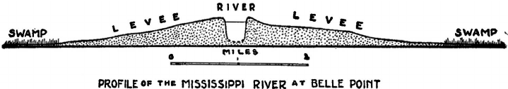
Along the river you have relatively high and dry ground. Behind, you have swamps, where the ground level is substantially lower than the surface of the river. When the river rises, the difference in height between river and swamp is substantial, many feet.
Humans, well clearly we’re not happy with the natural levee. It’s not nearly high enough, spring floods can overtop. Altogether way too unpredictable. So we build higher levees. Which occasionally fail catastrophically.
In the time period of the story, there were two massive breaches in manmade levees. In 1816, the Macarty crevasse. In 1849, the Sauvé crevasse. Each was miles upstream from the Old Quarter. In both cases the back of New Orleans was inundated. The lower places became lakes with feet of water. They cut drainage ditches leading toward Lake Pontchartrain to drain the city. You can’t drain it into the river, the river is uphill. These floods lasted a month or more.
The Macarty crevasse in 1816 was closer to the city, on a plantation that is now Carrollton. It left a vast deposit of silt that became the Lower Garden District, raising the ground level with rich, fertile soil perfect for… gardens. And making that part of town less prone to flooding. The Lower Garden District is a gift from the river flooding.
By 1849 New Orleans was a big city. The breach in the levee was a tourist attraction. Tour operators charged the curious for tickets. Steamboats would travel up river so people could watch from a safe distance as the Mississippi went where it wasn’t supposed to.
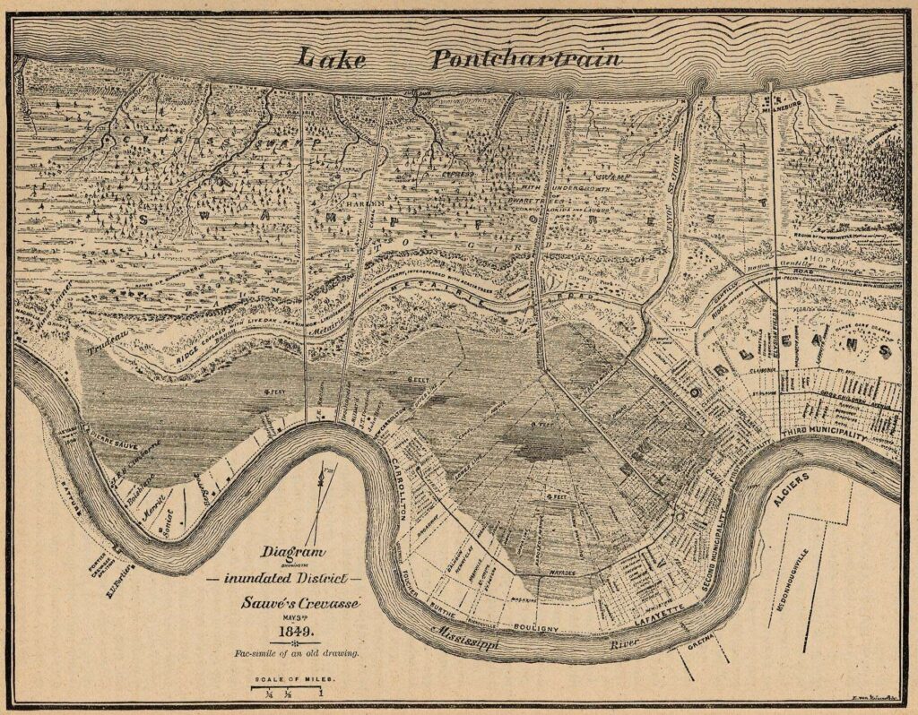
The map lists some of the major plantations. At the left side you can see the label for the Pierre Sauvé breach. The next plantation upriver, Trudeau. That was the René Trudeau plantation, the antagonist in the novel. He was dead by then, but the family still owned the property. That broad stripe of dry ground between river and flood? That’s the river’s natural levee.